


Check out what's new in Anderson Optimization's latest release (v1.6.0).
Want to make sure you're seeing the latest version of our site? Follow the instructions here.
Features and New Functionality
This release contains primarily backend changes (changes you won't directly see as a user) that will continue to help us work towards the redesigned look and feel of the platform. We overhauled the map backend and updated quite a bit of code architecture.
As always, we do our best to test updates before we release them, but if you notice anything that seems off or isn't working as expected, please let us know.
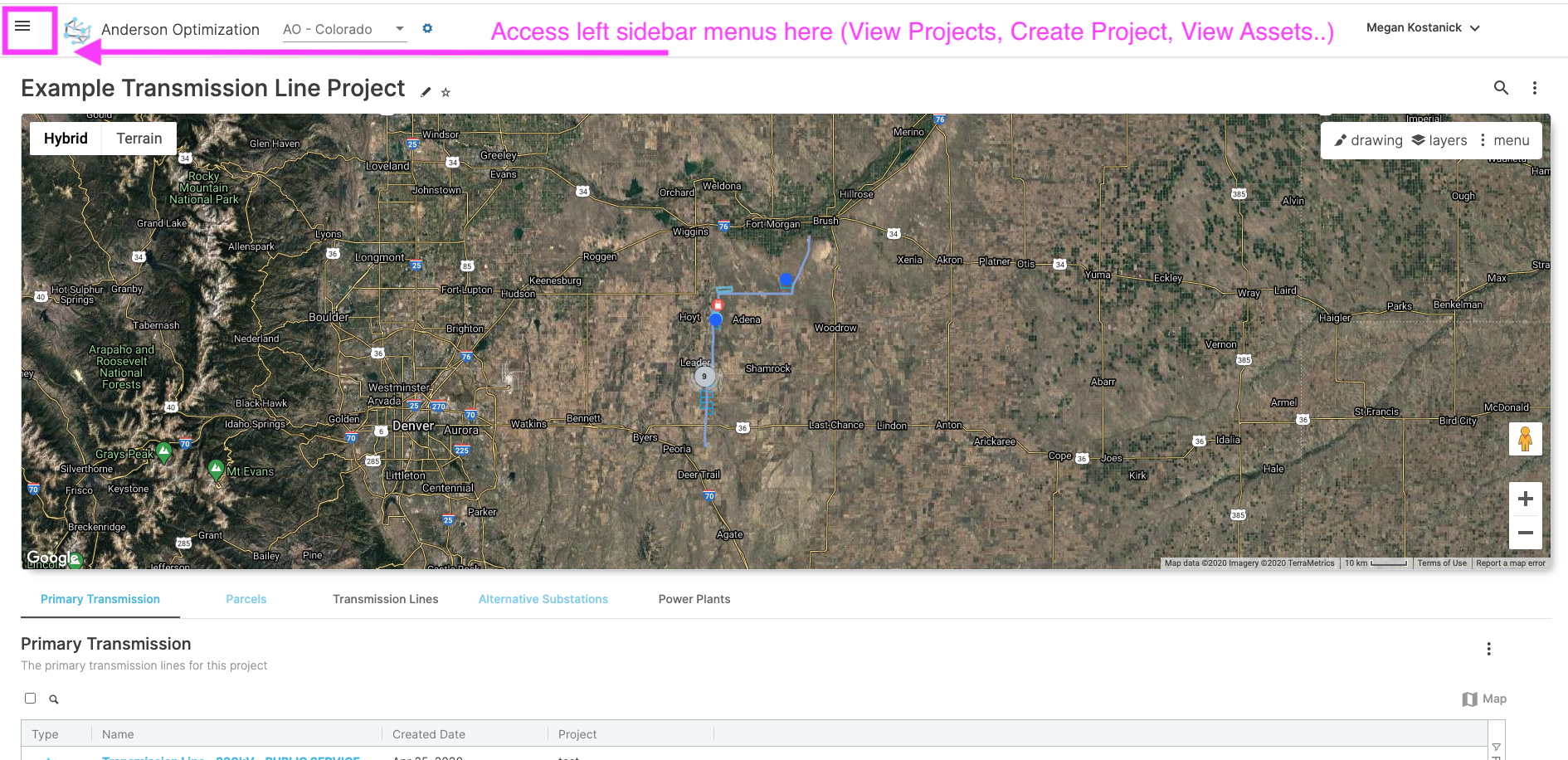
You may notice some interface changes, including:
Hidden sidebar/larger map: we are planning to make the map even bigger - this is just a start!
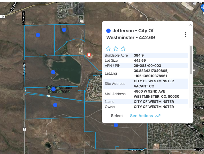
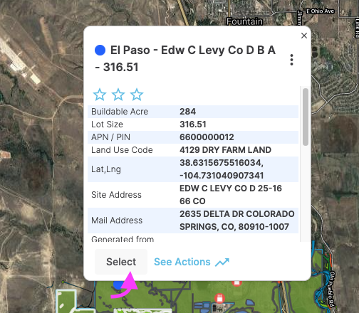
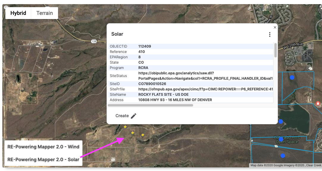
Updated map pop-up windows:
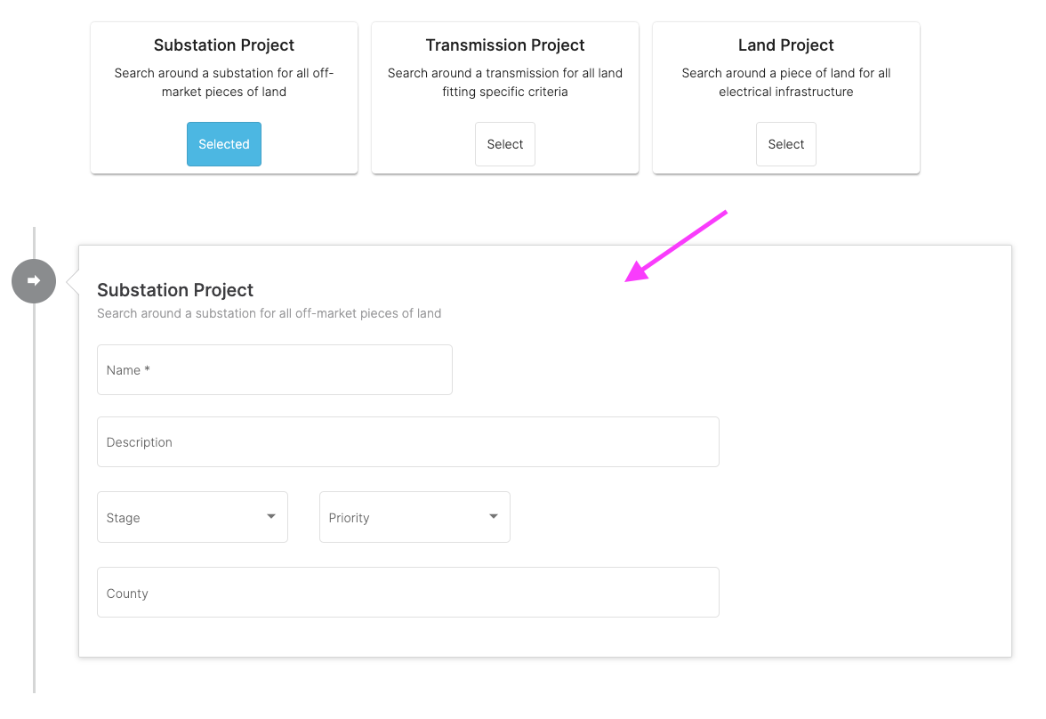
More streamlined project creation flow (AND 'County' added as an optional field for organizing projects).
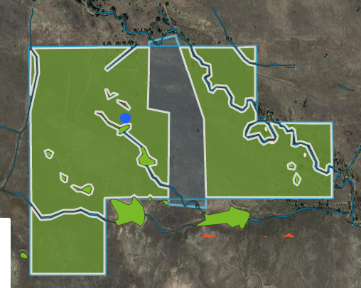
Modify Buildable Area Output
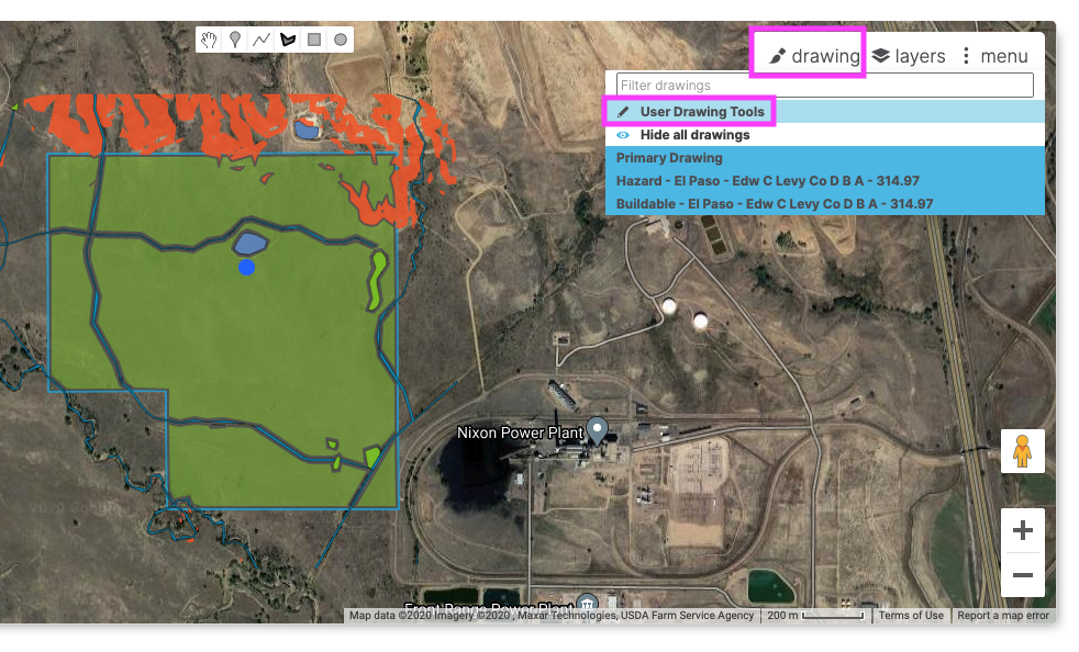
Manually update the buildable area constraint map to manually remove hazards/features that should not be included as 'buildable'.
- Run the buildable area analysis on the parcel, and then go to the asset detail page (Click on the blue parcel marker, then click 'Select' in the pop up)
- On the asset detail page map, turn on the drawing tools (Drawing menu > User Drawing Tools)
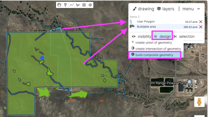
Draw out the hazard that you want to remove from the buildable area.
Once the drawing is done, multi-select the two polygons (CTRL + click the buildable area polygon to select it as well) (OR go to Menu > Select All)
Once the polygons have been selected, click on 'Design' and then 'build composite geometry').
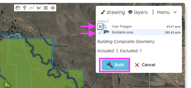
Click the bubble to the left of the user polygon drawing twice to indicate that it should be removed (from the original buildable area).
Click the bubble to the left of the Buildable area polygon once to indicate that the other polygon should be subtracted from this one.
Click 'Build'
- To finish updating the buildable area constraint map, click 'Update Buildable Area' in the pop up.
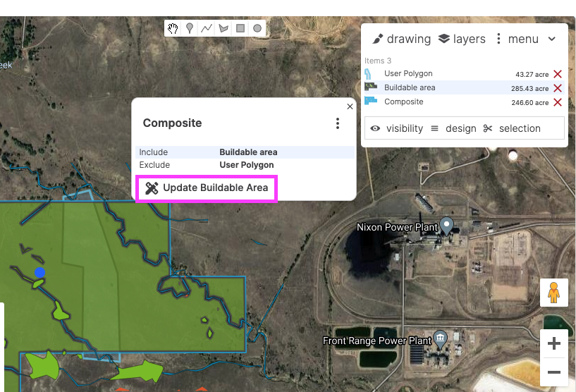
- This will change the styling of the green buildable area polygon to have a white border (indicating that it was manually modified from the automated output).
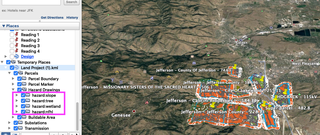
KML Export Settings
Sub-folders for Hazards
Exported KML files now group hazards into sub-folders based on the hazard type, so all slope polygons are in a sub-folder for slope, etc. This makes it simple to turn on and off entire hazard categories in Google Earth at once (e.g. you can hide all slope hazard shading or just view the buildable area shading).
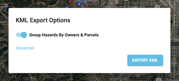
Group hazards by owners and parcels
In conjunction, we've added an additional setting in the KML export modal to group exported layers by parcel. Use this setting if you want to easily hide/show individual parcels (and all their associated layers).
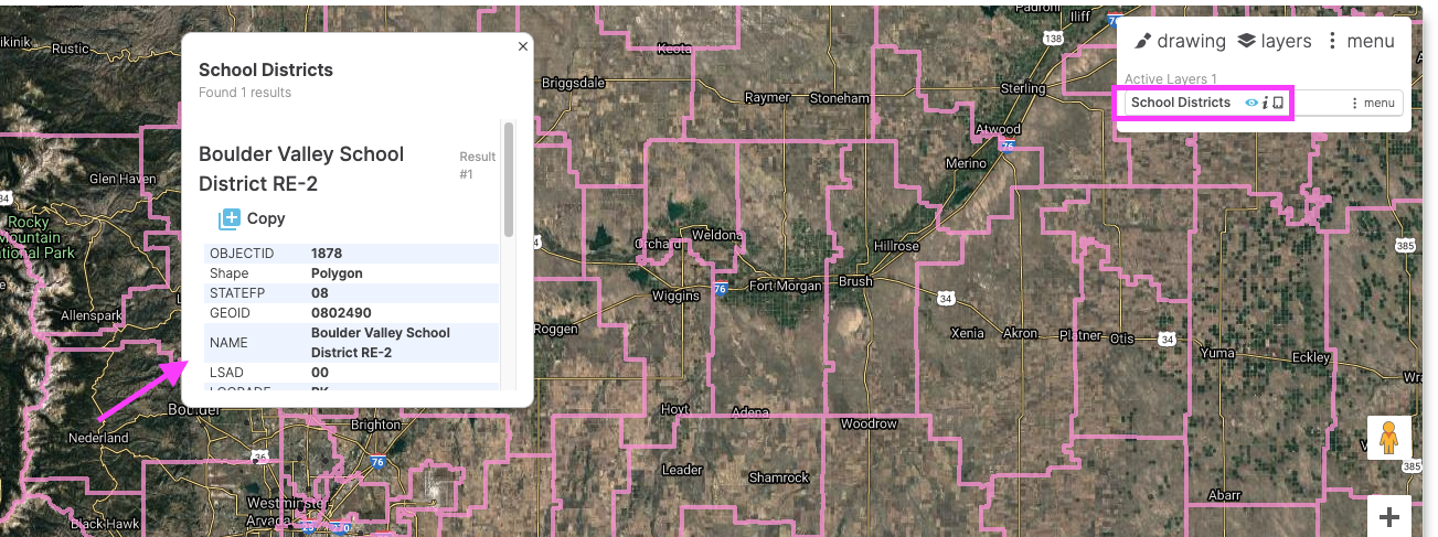
New Map Layers
Check out some of the new nationwide layers that were added this month.
School Districts
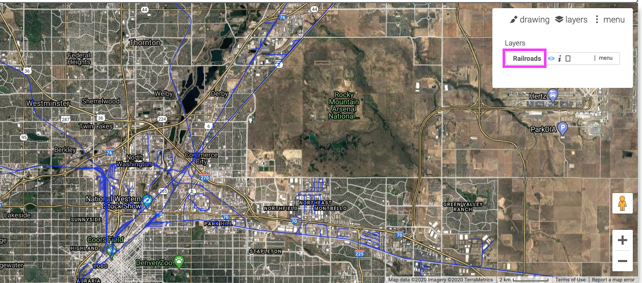
Railroads
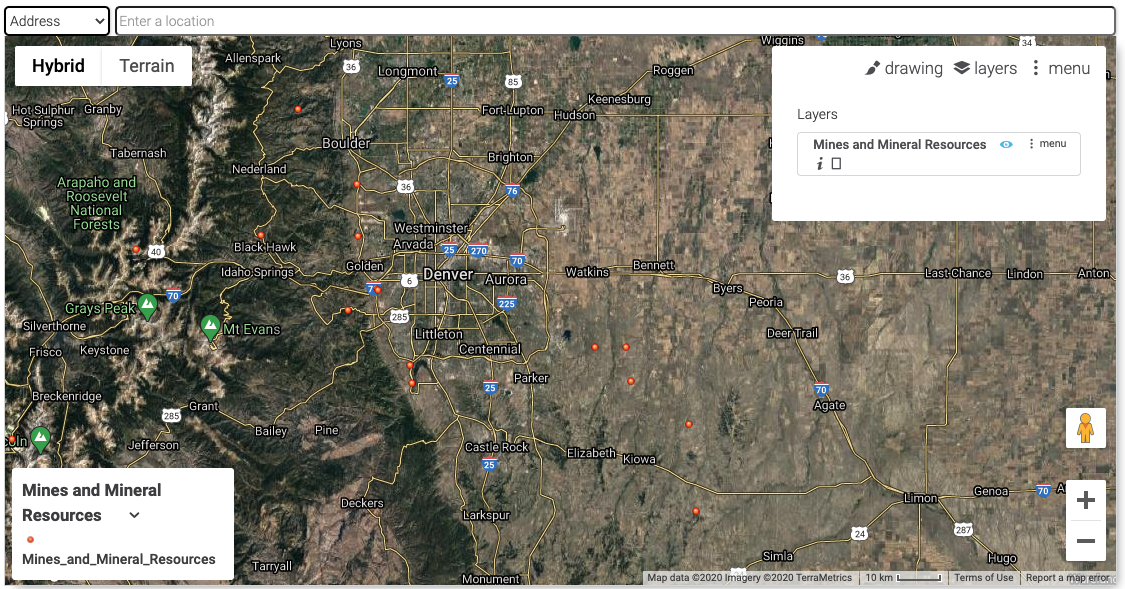
Mines and Mineral Resources
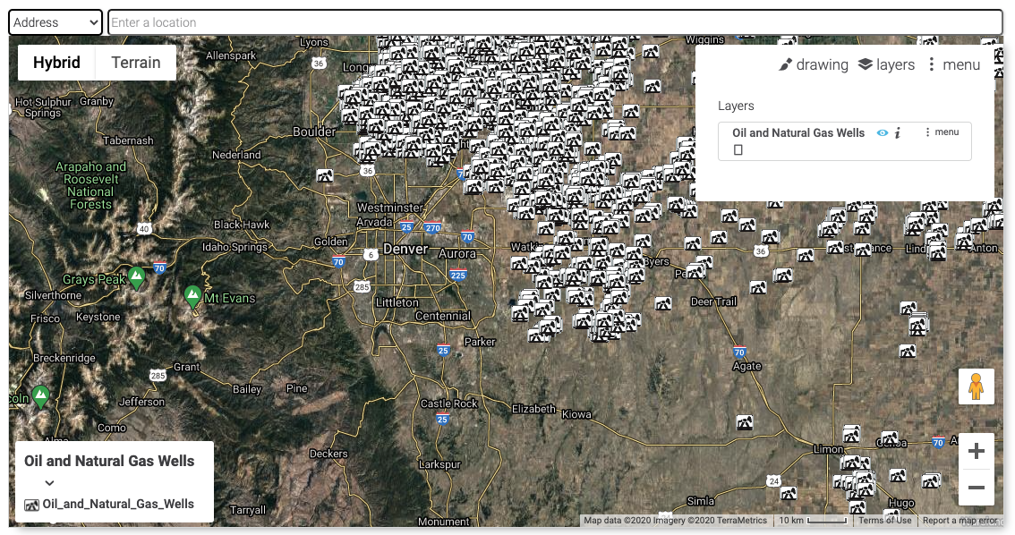
Oil and Natural Gas Wells
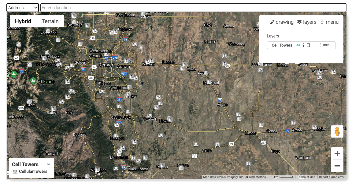
Cell Towers
RE-Powering Mapper
"EPA’s RE-Powering Mapper, an online interactive web application, allows users to visualize EPA’s information about renewable energy potential on contaminated lands, landfills and mine sites."
Fixes
- Added back parcel 'Owner' search to asset detail pop up (click on parcel, scroll down to asset tasks, and search by Owner).
- Fixed issue where map address search sporadically failed to complete the search.